I joined Geographical Information Science Lab in the Department of Geography in National Taiwan University. My academic supervisor is Professor Tzai-Hung Wen, Ph.D.
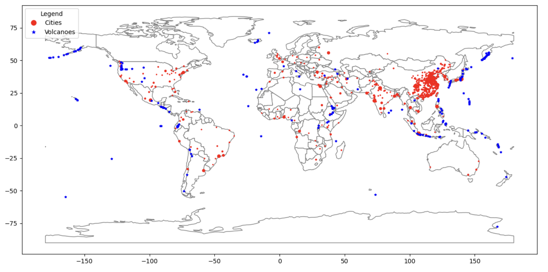
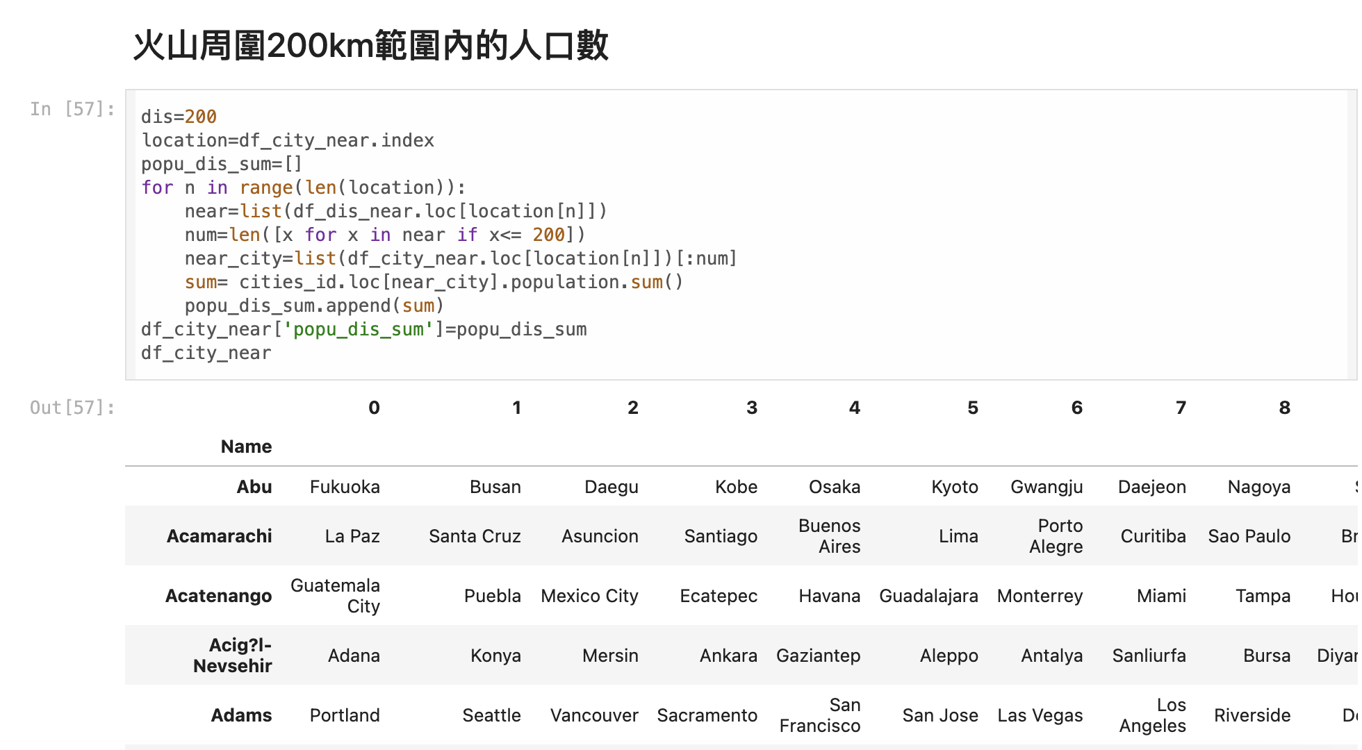
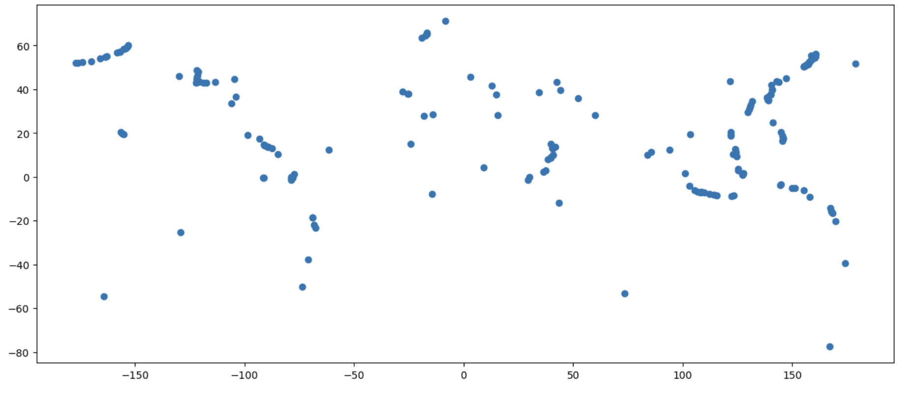
In this project, I perform a comprehensive spatial analysis to evaluate the potential threats posed by volcanic activity to global urban centers. Utilizing Python, I begin by mapping the geographical distribution of cities and volcanoes. I then calculate the spherical distances between these points to accurately measure their proximity on Earth's surface.
By linking each city's population size, I conduct a buffer analysis to identify cities that are potentially at risk due to their closeness to volcanic sites. This project aims to identify urban areas that could be vulnerable to volcanic hazards, thereby providing essential data for disaster preparedness and risk mitigation strategies.
在這個專案中,我進行了綜合的空間分析,以評估火山活動對全球都市中心可能帶來的威脅。我利用 Python,首先繪製城市和火山的地理分佈圖。接著,我計算這些點之間的球面距離,以準確衡量它們在地球表面的接近程度。通過連結每個城市的人口規模,我進行環域分析,以識別因靠近火山而可能面臨威脅的城市。這個專案旨在找出可能受到火山危害的城市區域,從而提供災害準備和風險緩解策略所需的重要數據。
[Python] 2022 Volcano-threaten Cities in the World, YANG YU HSIANG, 2022
I joined Geographical Information Science Lab in the Department of Geography in National Taiwan University. My academic supervisor is Professor Tzai-Hung Wen, Ph.D.
Any cooperation or suggestion is welcome to me. E-mail is on school system. Phonenumer and the Address is Geography Department of National Taiwan University
Since 7,August 2019 (Wed)